
Virtual Community Meeting
June 2, 2026 - click here to view recording of community meeting
Fort Lee Walking tour
June 24th 5:30-7pm
Join the City and Fort Lee Preservation Plan consultant team to learn more about Fort Lee and help plan for its future.
Click here or on image above to view draft document
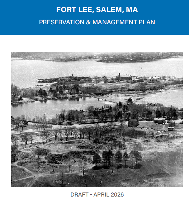
Fort Lee Preservation Plan
Fort Lee was constructed in 1776 at the beginning of the Revolutionary War. The relatively simple earthwork fort, laid out in an irregular four-pointed star form, was re-activated for both the War of 1812 and the Civil War. Fort Lee’s position on a high outcrop between Salem and Beverly Harbors demonstrates the significant role these harbors played in the nation’s coastal defense during the 18th and 19th centuries. In 1927, Fort Lee was deeded to the City of Salem for use as a public park. Today, the historic site is one of the last remaining unaltered late 18th century earthwork forts in Massachusetts and is listed in the National and State Registers of Historic Places.
In 2025, the City of Salem received a Survey and Planning Grant from the Massachusetts Historical Commission to develop a Fort Lee preservation management plan to identify strategies to preserve the fort’s historic integrity while improving its public accessibility and environmental sustainability. In the fall of 2025, a consultant team led by Kyle Zick Landscape Architecture began efforts to document the landscape using state of the art technology, including three-dimensional scanning of the fort and surrounding hillside. In addition, the team’s archaeologist researched the history of the site and identified archaeological resources still present at the fort.
In June 2026, the City will begin community outreach to present information gathered to date on the project and to seek input on preservation strategies and access needs to highlight and promote this historic site. Community meetings, a virtual presentation and a walking tour are some of the events planned.
For more information, please contact Patti Kelleher, Preservation Planner, at 978-619-5685 or pkelleher@salem.com.